Maine has over 6000 lakes and ponds
Many Maine lakes are large. 267 lakes are more than one square mile in size. Sebago Lake covers 4-5 square miles and Moosehead Lake 117 square miles. ” fish and wildlife (such as loons, eagles, ducks, cormorants, and moose).
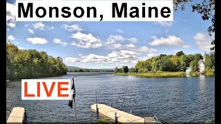
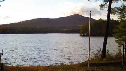
Maine Lake Webcams Map
LIVE MAINE LAKE CAMS


![Ellsworth Maine Webcam [VIDEO]](https://maine-webcams.com/wp-content/uploads/2022/07/download.jpg)


![Mt Katahdin Webcam - [LIVE VIDEO]](https://maine-webcams.com/wp-content/uploads/2011/09/mqdefault.jpg)

Lake or Pond???
Ever found yourself staring at a map of Maine, wondering, “Wait… is this a lake or a pond?” If so, congratulations—you’ve just asked one of the most common questions that keeps Maine DEP biologists up at night (okay, maybe not all night, but definitely during their coffee breaks). With about 6,000 inland bodies of water assigned state ID numbers, you’d think we’d have this whole naming thing down. Nope! Many of these watery wonders have two or even three names. Take Bryant Pond, which also goes by Lake Christopher—because why settle for one name when you can have two? Or Dexter Pond, which moonlights as Wassookeag Lake, just to keep things interesting. So, where do we draw the line between a pond and a lake? Somewhere between mild confusion and outright existential crisis. While you ponder that, why not check out our Maine Lake Webcams to see the mystery unfold in real-time?
Technically speaking (because science must prevail), one key difference is that ponds are shallow enough for sunlight to reach the bottom everywhere, while lakes have dark, mysterious depths where fish plot their next move. Another distinction? Ponds tend to have smaller surface areas, while lakes like to sprawl out and take up space. But let’s be real—Maine seems to have its own unique naming strategy that defies logic. Whether you’re looking at a pond that calls itself a lake or a lake that insists it’s a pond, one thing’s for sure: the best way to settle the debate is by seeing for yourself. Lucky for you, our Maine Lake Webcams have a front-row seat to all the action. So grab some popcorn and tune in—because even if you don’t find the answer, at least you’ll get a scenic view!
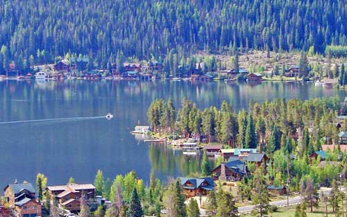
Here our TOP 5 Maine Lake Webcams, based on their surface area:
- Moosehead Lake – With a surface area of over 117 square miles, Moosehead Lake is the largest lake in Maine. It is located in the northern part of the state and is a popular destination for fishing, boating, and hiking.
- Sebago Lake – At approximately 45 square miles, Sebago Lake is the second largest lake in Maine. It is located in the southwestern part of the state and offers a variety of recreational activities, including swimming, boating, and fishing.
- Flagstaff Lake – Flagstaff Lake is located in western Maine and has a surface area of approximately 20 square miles. It is a popular destination for fishing, camping, and hiking, with several trails located in the surrounding mountains.
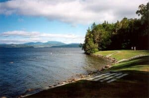
- Rangeley Lake – With a surface area of over 6,000 acres, Rangeley Lake is a popular destination for fishing, boating, and swimming. It is located in western Maine and is surrounded by forests and mountains.
- Great Pond – Located in the central part of Maine, Great Pond has a surface area of approximately 8 square miles. It is a popular destination for boating and fishing and is surrounded by several small towns and communities.
Maine’s lakes are known for many great features. They offer various recreational activities such as boating, swimming, fishing, and camping. Many lakes in Maine also have beautiful scenery and wildlife. They are also an important resource for the state’s economy, as they support thriving tourism and fishing industries. Additionally, Maine’s lakes play a crucial role in the state’s ecosystem, helping to regulate water quality and providing habitat for a wide range of plant and animal species. Maine Lake Webcams Map offers a great opportunity to check out live views of your favorite, or some new spots.